
For Everglades Agricultural Area (EAA) conveyance, stages were assumed to mimic historical data. Now structure characteristics and how they limit the load are included, so the model simulates discharges along the EAA canals more based on hydraulics instead of historical information and can make inferences on conveyance capacities along the EAA canals.
Figure 23 Everglades Agricultural Area Model
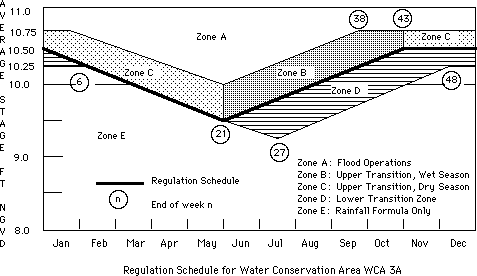
Figure 24. Water Conservation Area Regulation Schedule Zones

 Feedback: Home page maintained by Gopal Raghavan.
 Back to Home Page<
/A>
Back to Home Page<
/A> Table of Contents
 List of Figure
s
List of Figure
s Acronyms
 Previous Page
 Next Page
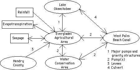